What lies beneath? The layered history of Seattle's community gardens

An old landfill, an abandoned airstrip, reclaimed wetlands, a public utility right-of-way, the top of a parking garage! All these are bits of the urban landscape repurposed for the growing of fruits, vegetables, and flowers.
One of the fascinating aspects of Seattle's community gardens is the variety of landscapes adapted for their use. Whether "interim" use or permanent, the gardens and p-patches have managed to find homes in odd and interesting places. In its own way, the story of locating gardens is one of waste not, want not.
Dumping grounds
Several p-patches have found a home on old dump sites. Dumps, both sanctioned and not, have typically been sited on undesirable land -- low-lying and perhaps swampy ground that is unsuitable for building. Such was the huge municipal dump and later landfill at Interbay, as well as the Montlake landfill, the latter on land reclaimed after the lowering of Lake Washington in 1916. Today the Interbay P-Patch occupies a corner of what was the Interbay dump (and later a golf course) with plots carefully laid out around a methane-collection system installed by the city in 1994. The UW Farm sits on the old Montlake dump site now capped and the home of Union Bay Natural Area and sports fields owned by the University of Washington.

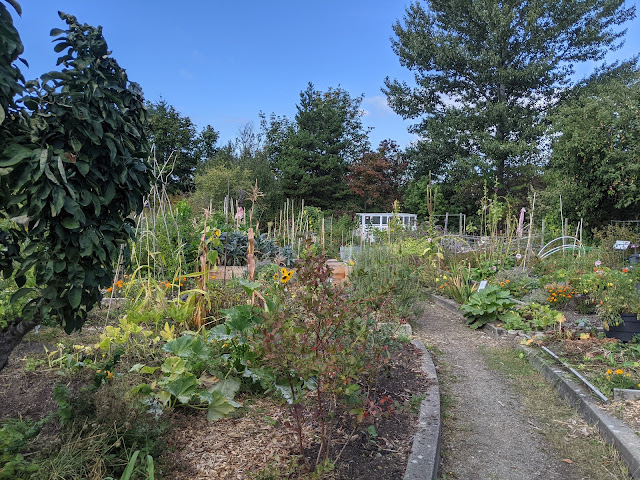
Other gardens have found a home in isolated patches of barren ground often targeted for phantom dumping. The Eastlake P-Patch sprouted on a garbage-strewn hillside between Eastlake Avenue and Fairview Avenue in 1981. Barbara Donnette, who became the P-Patch program manager, described what volunteers found under the blackberry vines in the unbuilt Shelby Street right-of-way:
In the late 1990s, the Eastlake P-Patch was forced to move, but only a very short distance to the south.

The Shelby Street right-of-way in 1941. Eastlake Avenue is at top; Fairview Avenue at bottom. The lower portion of the hill is the site of the original p-patch. Courtesy Seattle Municipal Archives, Image #39970.Water features
In 2009 the City of Seattle covered the West Seattle reservoir, at one time the largest reservoir supplying the city. The 30-million gallon storage pond was built in 1932 high on a ridge at the south end of West Seattle and is fed by the Cedar River. Like covering a landfill, the capping of open reservoirs has become a best practice, one that protects our emergency supplies of drinking water from contamination.
In the 1970s the city parks department, in cooperation with the water department, laid out a large park in the 76 acres surrounding the still open reservoir, one that afforded good views of downtown, mountains, and the Duwamish waterway. About 2015 a community garden was carved out on land just to the south of the reservoir on a plot bordered by flowering cherry trees, madrones, and maples. So new is the garden that maps posted at the park still label the area "picnic meadow."
Climbing Water P-Patch, in the Jackson Place neighborhood of Seattle, also has a connection to the Cedar River pipeline. It is sandwiched between apartment buildings on a steep slope adjacent to the pipeline. Climbing Water was established in 2006 on land leased from HomeSight, an affordable housing developer, and with the support of the Jackson Place Community Council.


Climbing Water P-Patch occupies a steep hillside in the Jackson Place neighborhood.
Layers
Several p-patches are located on deconstructed terrain -- tracts of land left barren after the tear-down of structures. One such is the Kirke Garden and P-Patch in Ballard, once the site of a religious millennialist community. Fragments of walls of a never-completed "temple" are built into the garden design. A few trees and shrubs tended by the sect's adherents remain as the legacy of the celibate community which dwindled and died away in 2008.
Another is, or, was the Sand Point P-Patch, a community garden that grew on the site of old navy housing at the base of View Ridge hill. That housing had taken the place of Japanese-run farms seized by the government in the early days of World War II. Gardener Leslye Coe recalls finding numerous nails in her plot. Today what was the Sand Point P-Patch has been layered over by a Children's Hospital complex, the garden moved across the street to Magnuson Park.
The site of Bradner Gardens Park has seen multiple layers of use. When Bradner P-Patch in the Mount Baker neighborhood was founded in 1987 it still had school portables on the grounds from the time it was used as a middle school annex (1971-1975). Until 1993 the structures were used by a nonprofit, Central Youth and Family Services. And prior to all of that it had been the site of the Quinsite-Bradner housing project (1942-53), emergency housing for veterans returning from World War II and the Korean conflict. Some folks still recall these "temporaries" around town that lasted much longer than the five years planned. The garden itself began as a p-patch for Southeast Asian refugees and later expanded into a community garden and park serving all neighbors. A basketball court added by the school district still stands.
The Hillman City P-Patch rests where two old houses once stood. When neighbors first leased the land from its owners and began to work the clayey soil they found pieces of cement foundations and car parts, according to Sue Gibbs.

Wall fragments frame a pathway to the Kirke Garden and P-Patch.

Above the waves
In 2010, Rainier Beach Urban Farm and Wetlands was established on the site of a defunct city nursery in the Pritchard Island neighborhood of Southeast Seattle. The 11-acre nursery, which grew plants for the city's parks and utility properties, occupied the land from about 1937 to 2010. Some old greenhouses and sheds remain. Atlantic City Nursery and neighboring parkland existed on land reclaimed from Lake Washington when that body of water was deliberately lowered in 1916 by the opening of the Ship Canal. Much of it is still wetland. The neighborhood, no longer an island after the lake lowering, was also the site of a Duwamish Indian settlement.
Today, RBUFW is run as a cooperative garden and educational farm in a partnership between the City of Seattle, Tilth Alliance, and Friends of the Rainier Beach Urban Farm and Wetlands.

Into plowshares
Magnuson Community Garden sits atop a man-made hill constructed from the debris of runways at the old Sand Point Naval Air Station. Aircraft parked along a runway just below this hill. Mark Huston, the garden lead, points to one of the tie-down hoops in the parking area.

The Sand Point Peninsula was once timbered ground, with a few farms and boatyards located on the north side at Pontiac Bay. The build-out of a county airstrip in the 1920s, followed by development of the huge Sand Point Naval Air Station in the '30s and '40s, forever changed the landscape of the peninsula. Today the community garden is one of dozens of entities bringing new life and purpose to what is now Seattle's second largest park.
The UpGarden
Perhaps the most unusual and creative location for a p-patch is the UpGarden, located atop the Mercer Street Parking Garage. The garden has taken up half of the third floor of the underutilized structure since 2012. Gardeners, most of whom live within walking distance, have created raised beds encompassing 86 patches. From their third floor perch they can take in a 360 degree view of the the Queen Anne neighborhood, including the Seattle Center and Space Needle.
Gardening on top of a parking structure comes with its own challenges. To begin with, all patches must be raised beds, since there is no subsoil. And the dirt that is poured into the beds must be lightweight: no clay or heavy compost. Water leakage into the parking tiers below has been an issue. Gardeners have made herculean efforts to re-configure their garden spaces and irrigation practices to mitigate leakage and allow access for garage maintenance.
The UpGarden glories in an automotive theme. A vintage Airstream trailer serves as an office/storage shed and a 1963 Ford Galaxie has been repurposed as a flower bed. In recent years, particularly during the pandemic, the garden has earned a reputation as a destination for those seeking unique photographic opportunities. Many are the "un-prom" photo shoots that have taken place here!


While not currently threatened, the UpGarden's ultimate fate is tied to that of the structure upon which it resides. If and when vague plans to "redevelop" the parking garage take shape, the UpGardeners may find themselves looking for a new home.
💮


Comments
Post a Comment